Wellington Dam is the South West’s largest dam and built to supply the Collie River Irrigation District. It is also the second largest man-made reservoir in Western Australia, Lake Argyle is the largest.
The original 31,000 megalitre concrete dam was opened in 1933, with a 240 metre long wall and 19 metres high, it was one of the largest public works of the “Great Depression” and contained 60% more water than Mundaring. More than a hundred workers that built the wall, lived in a tiny settlement of tents pitched in a forest clearing (now the Kiosk at the Dam and surrounding car parks).
The dam’s storage capacity has twice been enlarged to meet demand. At 186,000 megalitres, it is currently the State’s fourth largest dam. Only the Ord River (5,800,000 ML), South Dandalup (205,000ML) and Serpentine (190,000 ML) dams are larger.
The Collie River Irrigation District prospered with increasing demands for water. In 1944 the dam was raised 1 metre, increasing storage capacity to 36,000 ML. This still did not satisfy the water requirements and in 1946 planning began to develop a larger irrigation water source and provide a new scheme to pipe water to towns in the drier inland areas. Originally titled “The Comprehensive Scheme”, its southern section was named the “Great Southern Towns Water Supply Scheme” (GSTWSS).
In 1955 the dam was raised a further 15 metres to a height of 34 metres and a small hydro electric power station was built. Then completed in 1960, Wellington Dam’s storage capacity was increased to 186,000ML, its current capacity.
The scheme supplied around 600,000 hectares of farmlands east of Narrogin and properties along the main pipeline route. Annually they drew about 2,000ML.
Wellington Dam ceased supplying the GSTWSS in 1991 when the Harris Dam was opened.
During the 1950’s and the 1960’s rising salinity was detected in the water supplied by the Wellington Dam. With farmland clearing the removal of deep rooted vegetation in the catchment allowed groundwater levels to rise. This brought salt stored in the soil to the surface. Winter rains washed this salt into creeks and streams and into the Wellington Reservoir. To reduce salinity levels, a program jointly owned by the Water Corporation and the Dept. of Conservation and Land Management, was launched. Salinity levels are expected to stabilize in the medium term but, because these levels are unacceptable for domestic water supplies, The Harris Dam was built to supply the GSTWSS.
Wellington Dam services the Collie River Irrigation District which stretches from Benger to Dardanup. It comprises over 16,000 hectacres, 267 kilometres of channels, serves over 470 farms and now occupies virtually all the irrigable land available. The main land uses are dairying, beef cattle and horticulture, particularly fruit growing.

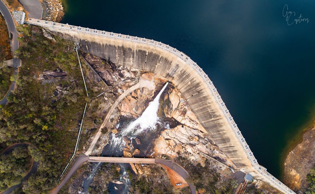
When the dam overflows it creates a spectacular lace curtain effect (pictured above) – a must see if you have the opportunity.
Location
Wellington National Park